
The Union Territory comprises two separate geographical units – Dadra and Nagar Haveli. It is close to on the Western coast of India between the parallels of 20° 0' and 20° 25' of latitude North and between the meridian 72° 50' and 73° 15' of longitude East. It occupies an area of 491 square kilometres (190 sq mi), comparatively equivalent to the Philippines' Biliran Island. It ranks 4th among the Union Territories and 32nd including the states. The territory is surrounded by Valsad District of Gujarat on the West, North and East and by, Thane District of Maharashtra on the South and South-East (after division of Thane district, it is now surrounded by newly formed Palghar District.).
An Administrator administers the territory, which covers an area of 487 km2 and consists of two talukas/ Blocks : Dadra and Nagar Haveli. Dadra is the headquarters of Dadra taluka, comprising Dadra town and two other villages. Silvassa is the headquarters of Nagar Haveli taluka, comprising Silvassa town and 68 other villages.
Dadra & Nagar Haveli. Endowed with nature's munificence, it's a land of spell-binding beauty... green forests, winding rivers, unimaginable waterfronts, gentle gurgle of streams, distant dotting mountain ranges, a gorgeous kaleidoscope of flora and fauna... Owing to its serenity and quaint sylvan surroundings, this territory is a heaven for those who hunt around for a tranquil holiday. The area of Dadra and Nagar Haveli is spread over 491 km2, landlocked between Gujarat to the north and Maharashtra to the south.
In order to keep the English at bay and to enlist their support against the Mughals, the Marathas made friends with the Portuguese and signed a treaty in 1779. According to this historic treaty of friendship, the Maratha-Peshwa agreed that the Portuguese will be allowed to collect revenue from Dadra and Nagar Haveli which consisted of 72 villages, then known as parganas in compensation for their loss of a warship called "Santana" which had earlier been captured by the Marathas but not surrendered to the Portuguese inspite of their many entreaties. These territories were earlier ruled by the Koli chiefs who were defeated by the Hindu kings of Jawhar and Ramnagar. The Marathas conquered and annexed these territories to their kingdom.
Dadra &Nagar Haveli was liberated from Portuguese Rulers by people themselves on 2nd August 1954 . The people of the U.T. established free Administration of Dadra & Nagar Haveli, which was finally merged in to Union of India in the year 1961.
LAND, PEOPLE & CULTURE
The U.T. of Dadra & Nagar Haveli is located on the western side of the foot hills of western Ghat and has undulating terrain 40% of the total geographical area is covered with forests and thus offers it a look of woodland. The major river Damanganga and its tributaries criss-cross the U.T. and drain into Arabian sea at Daman . The U.T. has population of 2.20 lakhs as per the 2001 census which has predominance of tribals forming a major chunk of 62% of the total population.
The major tribes are Varlies, Kokana, Dhodia and Dublas. The tribals have their distinct culture of their own consisting of curious rituals and colorful folk-lore. No occasion in tribal life is complete, be it a marriage or harvest without a folk dance. The major dances are Tarpa, Dhol, Bhavada and Gherria. The performers of these foot-tapping dances are equally good in other arts and art forms and are almost independent for most of their daily requirements.
SALIENT FEATURES
As per census 2001, the tribals constitute 62.24 % of the total population of the territory . the main tribes are Dhodia, Kokna and Varli with small groups of Koli, Kathodi, Naika and dubla scattered over the territory. The Dhodias and Dublas are mainly confined to the Northern part of the territory whereas the Koknas and Varlis and found all over. From the total population of Tribals, the Varlis consitute 62.94 % and the Koknas and Dhodias comprise 16.85 and 16.90 % respectively of the tribal population., 2.29 % Dublas, 0.08% Kathodis, 0.84% Kolghas and 0.08% Nayakas being the smallest groups represents 3.31% of the population together situated between the foothills of Western Ghats on one side, and the Arabian Sea on the other, this land of colorful tribals is known as Dadra & Nagar Haveli.
This area of 491 sq.kms. is the home land of nearly one lakh people of various tribes. It has seen many rulers, ranging from the mighty Marathas to the fiery Portuguese. Yet, the essence of tribal life, its richness and variety, its art, myth, song and folklore, have all remained unchanged.
HOW TO REACH
The nearest Railway station is Vapi on Western Railway.All major Mail/Express trains are available at Vapi including August Kranti Rajdhani, Satabdi, Ahinsa, Karnavati etc. The UT of Dadra & Nagar Haveli is almost touching Mumbai - Baroda - Delhi National Highway No. 8 (Western Express Highway). Silvassa is about 14 Kms from Bhilad & 18 Kms from Vapi. Mumbai 180 Kms, Surat 140 Kms, Nasik 140 Kms and Daman 30 Kms.

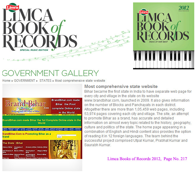
Bihar became the first state in India to have separate web page for every city and village in the state on its website www.brandbihar.com (Now www.brandbharat.com)
See the record in Limca Book of Records 2012 on Page No. 217